Advocating for Walking & Cycling:
Planning Melbourne’s cycling network - 780km of future trails
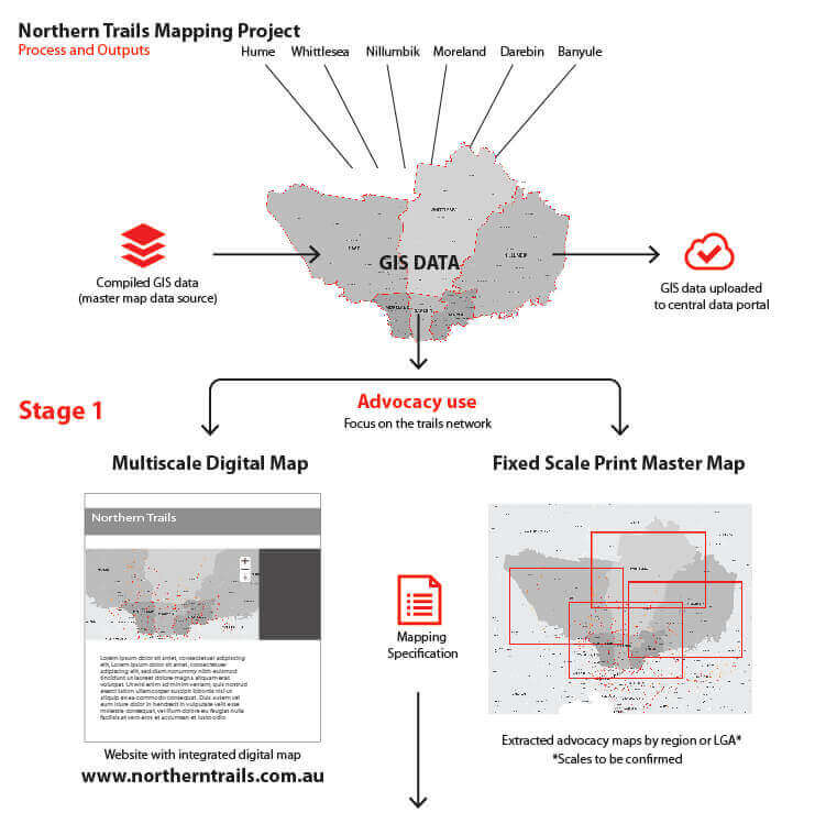
Visualvoice was approached by the Northern Trails Project Steering and Working Groups comprising six northern councils to develop an Advocacy Map with GIS integration to seek Victorian State Government funding for the development of 13 priority cycling trail projects over the next 4 years, to a value of $30 million.
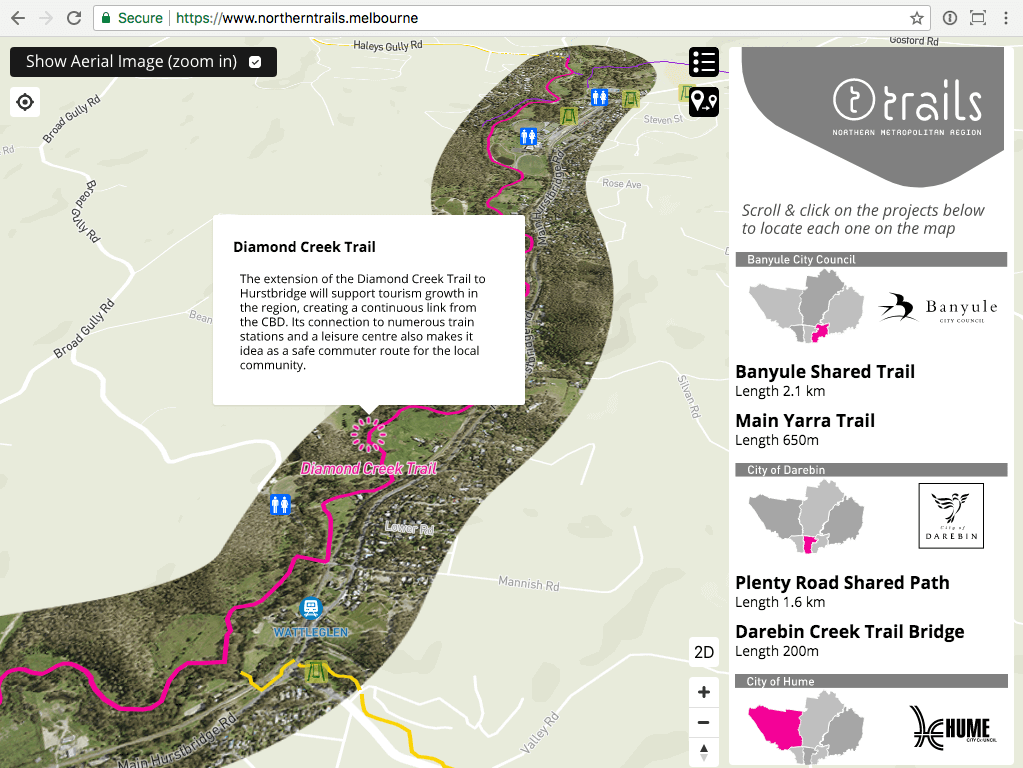
The map is unusual in that as a custom map it displays relevant content only, delivered in a consumer friendly style.
Visualvoice combined GIS data from each council including current high resolution aerial imagery (where available), to provide localised context for each project. Users can select either a 2D or 3D view of the map which shows all the trails. Each one is named and colour coded according to whether they are current, future or priority, making them easy to identify and locate.
There are 2 options for identifying and getting information about each trail. The first option is to click on the trail name which reveals a short written description of it. As the user zooms in, the map falls away to reveal the current aerial imagery showing the coloured trail running through it. Alternatively, users can click on the trail name in the scrolling side bar/list which moves the map to it’s location. Both options are quick and easy to activate and highly legible.
Explore the map here: northerntrails.melbourne
Five of the councils committed funding for Visualvoice to develop the digital/print map which seamlessly covers the whole northern region over a 60km wide area. The map shows current, future and priority trails along with tourism and recreation destinations, amentities such as toilets and playgrounds and transport networks.
The map is hosted under www.northerntrails.melbourne and available to each council for future use and promotional purposes.